India Needs to Map Water to Prepare for Drought and Flood
Published by Water Network Research, Official research team of The Water Network in Academic
An integrated observation system in India is essential to manage the food-energy-water nexus and better prepare for drought and flood.
Farmers all over India – especially those who do not have irrigation facilities – are now using the agricultural meteorology or agrimet service of the India Meteorological Department and they can get crucial information such as rainfall forecast over the next week through text messages on their phones.
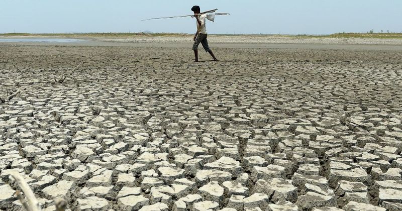
Image: Drought in India
Image credit: Arun Sankar/AFP
There is a lot that can and should be done to extend the scope of these weather predictions to large-scale hydrological predictions, both short and long term, so that farmers and administrators can plan for the more frequent and more severe floods and droughts that are occurring in South Asia because of climate change.
Information about water flow in rivers is now available through a water resources information system, but that has severe limitations due to regulatory issues – there is no information available to the public about real time water flow in transboundary rivers, thanks to an outdated law.
This means there is no real time water flow information available in the public domain from the three largest river basins in the country – those of the Indus, Ganga and Brahmaputra. This clearly affects preparations to face floods.
When it comes to drought preparedness, the situation is similar – the information available is better than before but not good enough. The Central Water Commission now puts out in the public domain the water storage status of the 91 largest reservoirs in India and updates this information every week. This list still leaves out far too many water bodies that are crucial in determining if a region will face drought.
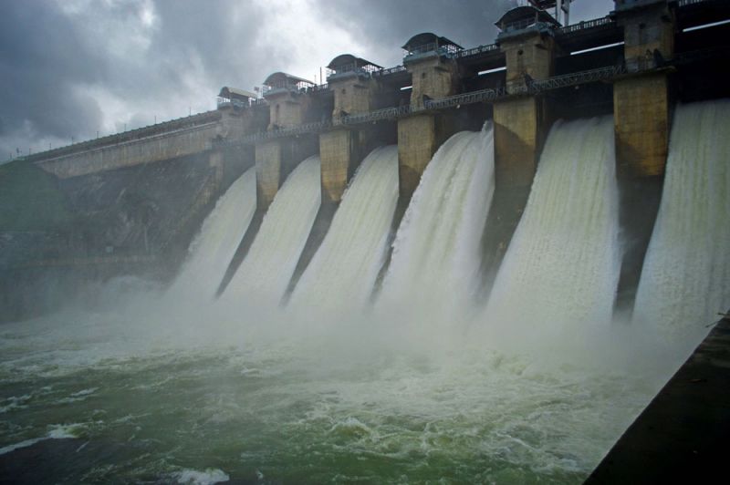
Image: All four gates opened at the Hemavathi reservoir in Karnataka, India.
Image credit: Darshan Simha
India is a country where over half the irrigation is from groundwater. It is the world’s largest groundwater user.
There is another shortcoming – India does not have enough monitoring stations to map air pollution over the country. Most of the monitoring stations are scattered over a few large cities, though satellites show the most polluted zones to be in and around industrial townships and highways. Improving this observation system is crucial because air pollution – especially through aerosols – affects local and regional weather patterns.
Improving these hydrologic and air quality information systems is essential to manage the crucial food-water-energy nexus in a warming world. This will need integrated observations and predictions, which can be carried out through a Regional Earth System Prediction framework.
Regional Earth System Prediction treats land, ocean, atmosphere, ecosystem, agriculture, and human interactions as components of one integrated system. This has to be used with an integrated observation system that provides the data needed to build, validate and verify local and regional weather and long-term climate system models.
For information essential to manage the food-energy-water nexus, India needs two steps:
- to improve its hydrologic and air quality information systems
- a national strategy to integrate the weather and climate information with the hydrologic and air quality information and manage this together.
Source: Scroll.in
Tags
Category: Academic
- Food Security
- Water Resource Mapping
- System Integration
- Integrated Water Management
- Drought
- Flood Management
- Integrated Water Management
- Flood management
- Groundwater Mapping
- India
3 Comments
Hi
Every domestic-wastewater treatment systems are based on the principle of effluent filtration which results in the production of sludge. The filtration can not do otherwise than transform the fecal matter, and any other organic material, into mud. France generates more than 25,000 tons of sewage sludge for a global production of 45 million tons per year.
The problem in this way is twofold.
- On the one hand, the production of sewage sludge obliges the installation of successive palliative treatments, which are equally expensive and ineffective, since each palliative treatment generates residues. The collection of wastewater in a wastewater treatment plant produces effluents of high biochemical toxicity, to which must be added the chemical industrial micro-pollutants.
- On the other hand the mud, whatever its origin, is a non-recyclable product that nature does not assimilate. It ends up in the bottom of the surface water in the form of a muddy vase. Its destruction by the various unicellular organisms, worms, gastropod molluscs which colonize it is evaluated in time / year. It's an environment in a permanent state of putrefaction under the action of a strong methanization which evaporates in the atmosphere, adding to the atmospheric pollution.
Lyseconcept Society, with its concept of Biological Sanitation active 14 to 16 biological parameters within its process "Lyseconcept Biological Pit".
Result: Favorable conditions that promote the complete destruction of fecal matter through the biodegradation of beneficial bacteria that have no effect on diffuse urinary pollution.
The residual water, discharged from the recyclable device, is immediately dispersed on a vegetated outlet that completes the work of cleaning the wastewater by purifying the receiving environment of urinary pollution.
This water used to water the vegetalized biodiversity saves money on this rare resource: potable water. Having no more wastewater discharged into the ground, the phreatic zones are no longer polluted.
The process “Pit Biological” Lyseconcept preserves a rare resource: water.
Good reception
Cordially
Jean Marius D'Alexandris
Telephones.
mobile: + 33 (0) 6.03.65.87.26
Fix phon: + 33 (0) 494.423.190
courriel: lyseconcept@gmail.com
Site web:www.lyseconcept.fr
http://www.viadeo.com/profile/0021xx48rdprt8er,
https://www.linkedin.com/profile/view?id=76857248&trk=nav_responsive_tab_profile,
http://www.interet-general.info/spip.php?article19572
Scientific communication
- The organic matter by Lyseconcept
- The anaerobic does not exist on Earth, the anaerobic cannot exist on our planet
Member of the order of the International Experts
"Let's protect today what we have been given yesterday to better restore it tomorrow. »
Dear Dr. Raghu Murtugudde,
You have brought out a very important point of dealing with drought and flood on basis of the information collected every year. Which has now been updated in South India but still has to be fully implemented in North India. The analysis for long term planning for water and land availability upto the year 2050 is still to be taken up on a full hydrological-cycle basis in a holistic manner.
This work for land and water use for full hydrological-cycle from sea, clouds, various uses of land and flow of balance water back to the sea from each river basin for starting the cycle again. A study 'Water Resource of India' was done in 1974 by the National Commission on Agriculture. More recently ‘Management of Land and other resources for inclusive growth: India 2050’, which gives a more updated picture of management (Link: http://alternativefutures.org.in/userfiles/file/Urbanisation%20paper%20AF%20rev_%20ver5%202015.pdf).
In the last five years more improvement in technology at reduced cost has come-up like: solar power, wind power and desalination of sea water and salted groundwater for further improvement. Due to climate change and the recent indications that the low level clouds giving rainfall may also get reduced, affecting the precipitation in quantity and space. A new study is required by a team of various experts to consider all these factors into account, so as to achieve socio-economic improvements for 1600 million people by 2050. The policy of allocating land and water for various sectors has to be decided for balanced development.
Almost 70-80% of water and land is polluted, which is to be given top priority for cleaning and preventing future pollution. All types of waste in rural and urban areas should be converted into energy, manure and other usable items, with the help of water harvesting and solar power. In the past 20 years due to miss-management of forest, flood plains and the mountains and hills, groundwater recharge during monsoon has reduced and flood flows have increased in intensity which have to be corrected and prevented in future. Floods and droughts cannot be prevented by annual information and disaster management only.
Published by G N Kathpalia, Chairman, Alternative Futures
@India needs to map water to prepare for droughts and floods.
Better Groundwater Governance Only Can Ensure Sustained Water Supply
I have pleasure to inform all that I have authored a book entitled "Better Groundwater Governance Only Can Ensure Sustained Water Supply", published by Lambert Academic Publishing, Germany. (ISBN: 978-3-330-32219-6). The book has been released at the price of 49.90 € Euro on permanent links on morebooks.de, amazon.com,
For water security point of view, I request all to give wide publicity about this book, because, I think public (including all stakeholders) by an large has taken water for granted. The book will be also very useful for students and researchers.
Blurb: All countries are confronted with water scarcity of varying types. The daunting biggest challenge for the authorities is in protecting groundwater from depletion and pollution, and making sound managing decisions on complex issues/activities that may affect water supply at local and basin scale. For short-term situation management when water supplies are affected, the managers usually adopt approaches, which involve eliminating immediate, unacceptable impacts on human and the environment, groundwater-use restrictions, regulation, balancing time and resources. However, these may require more research, time, regulations, funding, technology, etc., and be expensive/complex. This book identifies the issues that affect water supply; and makes scientific endeavors to improve all stakeholders’ awareness and understanding of real groundwater problems, and suggests governance approaches by relevant policies, with strong peoples’ participation efforts by behavioral change. The analysis may be especially useful to professionals in water governance and communications for long-term solutions to ensure sustained water supply, reducing costs and implementing water resources protection strategies, for public benefit.
Published by Prof. Partha Sarathi Datta, Independent Consultant on Water & Environment
3 Comments
@ Iyseconcept jean Marius.
Hello my friend, you need not feel sorry. Please read my book.
Nice to know that the presentation seem to you totally idealistic.
If you read the book attentively, you will find that the book not only describes the issues, but also suggest real practical solutions, taking into consideration what you think as the only problem i.e., the rejection of wastewater into the environment without treatment, and also, by establishing very expensive and ineffective high-performance technologically advanced wastewater treatment infrastructure.
Better governance by a change in mental attitude and behavior of all the stakeholders is very essential through public awareness programs.
- Prof. Partha Sarathi Datta, The Author of the Book.
Independent Consultant on Water and Environment, (Former Director, NRL, IARI), New Delhi; with four decades of experience in extensive outreach hydrological investigations covering many river basins in India.
Published by Prof. Partha Sarathi Datta, Independent Consultant on Water & Environment
Hello I'm sorry, but this presentation is totally Utopian. It only describes an issue without making any real solutions.
What is the problem? Water consumption? Its use? But no we're away from all this.
Humans need water to live and he only is gene not to use it. Advances in technology of urban planning, health, food, appropriate water for a more comfortable life.
There - it enough water in reserve around the world? Yes it's not exhaust it.
The problem is elsewhere and I am surprised that no one make her stand out.
The problem is only in the rejection of the wastewater into the environment without him having previously purified see purified.
The Earth has a huge water regeneration system to make drinking water. Humans interfering on this process allows pollution in General to seep into the groundwater.
We soon reach when humans will build factories to clean up drinking water. But as he can't seem to clean up these own sewage I'm not sure of the effectiveness of the process that he put a in place.
The modern world by these ultra high-performance technological advances disempowers the man of the pollution it generates. Is not by building very expensive but ineffective infrastructure wastewater treatment that man will be interested in this problem even by writing a book. Environmentalists around the world draw attention to this issue. By participating in the governance environmentalists don't is not tackling this problem.
For 120 years now we suggests that wastewater management is ultra efficient. Off it provides no treatment of the pollution that it rejects in various forms in the environment, thus distorting the vision of this management.
The problem of drinking water is closely linked to the problem of wastewater management: its main source of pollution. As long as we don't if endeavoring not to solve this management of wastewater with a comprehensive and definitive real sewage solution, the problem will persist much longer
Bonjour Je suis désolé mais cette présentation est totalement utopique. Elle en fait que décrire une problématique sans apporter de solutions réelles.
Qu'en est il de la problématique? la consommation d'eau ? son usage? Mais non on est loin de tout ceci.
L'homme a besoin d'eau pour vivre et il ne se gène pas à l'utiliser. Les avancées technologiques d'urbanisme, de santé, alimentaires, s'appropient l'eau pour un meilleur confort de vie.
Y a t-il suffisamment d'eau en réserve de par le monde? Oui on est loin de l'épuiser.
La problématique est ailleurs et je suis étonné que personne ne la fasse ressortir.
La problématique tient uniquement dans le rejet de l'eau usagée dans l'environnement sans l'avoir au préalab le épurée voir purifiée.
La terre est équipée d'un énorme système de régénération de l'eau pour en faire de l'eau potable. L'homme en interférant sur ce processus peremet à la pollution en générale de s'infiltrer vers les réserves souterraines.
Nous arrivons bientôt ou l'homme devra constuire des usines de dépollutions de l'eau potable. Mais comme il n'arrive pas à dépolluer ces propres eaux usées je ne suis pas certains de l'efficacité des processus qu'il mettre a en place.
Le monde moderne par ces avancées technologiques ultra performantes déresponsabilise l'homme de la pollution qu'il génère. Ce n'est pas en constuisant des infrastructures très onéreuses mais inefficaces dans l'épuration que l'homme s'intéressera à cette problématique même en lui écrivant un livre. Les écologistes de par le monde attire l'attention sur cette problématique. En participant à la gouvernance les écologistes ne s'attelent pas à cette problématique. Depuis maintenant 120 ans on laisse croire à la population que la gestion des eaux usées est ultra preformante. Hors elle n'assure aucune épuration de la pollution qu'elle rejette sous diverses formes dans l'environnement, faussant ainsi la vision de cette gestion.
La problématique de l'eau potable est intimement liée à la problématique de la gesiton des eaux usées: sa principale source de pollution. Tant que l'on ne s'attèlera pas à résoudre cette gestion des eaux usées avec une solution globale, définitive d'une réelle épuration, la problématique persistera encore longtemps